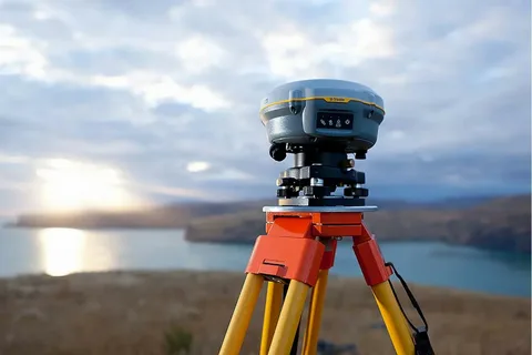
Global Navigation Satellite Systems (GNSS), such as GPS, have revolutionized how we navigate, map, and manage our world. While gnss provides significant utility in positioning, its accuracy can vary—often limited to several meters. For industries where centimeter-level precision is critical, a more advanced technique is needed. This is where Differential GNSS (DGNSS) comes in. In this article, we delve into “Enhancing Precision: Differential GNSS Explained”, exploring how it works, where it’s used, and why it’s essential for high-accuracy applications.
What is Differential GNSS?
Differential GNSS is an enhancement to standard GNSS that improves location accuracy by correcting signal errors. It works by using a network of fixed ground-based reference stations that compare their known positions with satellite-provided positions. These stations calculate correction data and transmit it to nearby mobile receivers, which apply the corrections in real time or post-processing.
This method reduces errors caused by atmospheric disturbances, satellite orbit deviations, and clock inaccuracies—common sources of GNSS errors.
How Does It Enhance Precision?
The primary goal of Differential GNSS is to deliver high-precision positioning, often reducing errors to less than a meter, or even to the centimeter level with advanced implementations like Real-Time Kinematic (RTK) or Precise Point Positioning (PPP).
In the context of Enhancing Precision: Differential GNSS Explained, the system’s value lies in its ability to provide:
- Real-time corrections: Improving navigation in dynamic environments.
- Consistency: Essential for applications like surveying and precision agriculture.
- Reliability: Boosts confidence in automation systems, especially in aviation or marine navigation.
Applications of Differential GNSS
Several sectors depend on DGNSS technology for accurate and reliable positioning:
- Agriculture: Enables precision farming by guiding tractors and managing crop inputs efficiently.
- Surveying: Provides exact measurements for construction, land mapping, and infrastructure planning.
- Maritime Navigation: Improves safety and efficiency for vessels navigating busy or shallow waters.
- Autonomous Vehicles: Supports self-driving systems by delivering precise location data in real time.
In each of these applications, enhancing precision: Differential GNSS explained is not just a concept but a critical operational advantage.
Conclusion
As industries demand higher accuracy and reliability in positioning systems, the role of Differential GNSS becomes increasingly important. Whether it’s guiding a tractor across a field or ensuring the safe docking of a ship, the technology behind enhancing precision: Differential GNSS explained is making a tangible difference. With continued advancements, DGNSS will remain a cornerstone of high-precision navigation for years to come.

